Geographic Information System & Remote Sensing
"By:"Mostafa SadeghnejadGeographic Information System & Remote Sensing
"By:"Mostafa Sadeghnejadدرباره من
 اینجانب مصطفی صادق نژاد کارشناس ارشد GIS و سنجش از دور و دانش آموخته مهندسی منابع طبیعی(مرتع و آبخیزدازی)دانشگاه تهران میباشم.مشاور در امورGIS- سنجش از دور- آبخیزداری-نقشه برداری-برنامه نویسی-تفسیر تصاویر ماهواره ای میباشم.برای ارتقاء و همکاری و هرگونه فعالیت علمی پژوهشی دست همه را به گرمی میفشاریم.دانش را برای آنکه خواهان نیست،عرضه مکن (کنفوسیوس)-ترس از انتقاد،موجب مرگ نبوغ میشود(ویلیام سیمز).انتقادات و پیشنهاد خود را به ایمیل زیرارسال نمایید.
پست الکترونیک : sadeghnejad@ut.ac.ir
ادامه...
اینجانب مصطفی صادق نژاد کارشناس ارشد GIS و سنجش از دور و دانش آموخته مهندسی منابع طبیعی(مرتع و آبخیزدازی)دانشگاه تهران میباشم.مشاور در امورGIS- سنجش از دور- آبخیزداری-نقشه برداری-برنامه نویسی-تفسیر تصاویر ماهواره ای میباشم.برای ارتقاء و همکاری و هرگونه فعالیت علمی پژوهشی دست همه را به گرمی میفشاریم.دانش را برای آنکه خواهان نیست،عرضه مکن (کنفوسیوس)-ترس از انتقاد،موجب مرگ نبوغ میشود(ویلیام سیمز).انتقادات و پیشنهاد خود را به ایمیل زیرارسال نمایید.
پست الکترونیک : sadeghnejad@ut.ac.ir
ادامه...
آمار : 14176 بازدید
Powered by Blogsky
نهمین کنفرانس بین المللی اطلاعات مکانی برای مدیریت بحران
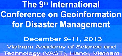
The 9th International Conference on
(Geoinformation for Disaster Management (Gi4DM
Conference Theme
Earth Observation for Disaster Management
Conference official e-mail address
gi4dm2013@gmail.com
Important Information
- Date: December 9-11, 2013
- Venue: Vietnam Academy of Science and Technology, 18 Hoang Quoc Viet Rd., Cau Giay, Hanoi, Vietnam
- Organizer: Institute of Geography and ISPRS
- Regular Registration fee: USD 200.0
- Early bird registration: USD 150.0 before September 1, 2013
- Local participant registration fee: USD 100.0
The conference will concentrate on the following topics:
- Small satellite programs
- Remote sensing and GIS as tools for disaster management
- Landslide monitoring and data processing
- Flood analysis
- Drought monitoring
- Forest fire control
- Urban Analysis
- Earthquake and geo-hazards
- Coastal and ocean pollution
- Desertification and land degradation
- Search and rescue activities in disasters
For more information click here
برای نمایش آواتار خود در این وبلاگ در سایت Gravatar.com ثبت نام کنید. (راهنما)


ایمیل شما بعد از ثبت نمایش داده نخواهد شد